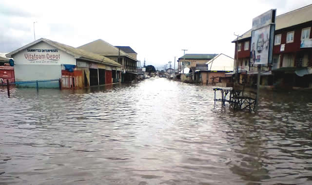
The Nigerian Red Cross Society (NRCS), has said it reached 142,915 people in Jigawa State with flood early warning messages under the Shock-Responsive-Social-Protection (SRSP) project.
Kefas Shutty, Project Officer, NRCS, stated this on Tuesday at a training exercise for Civil Society Organisations (CSOs) and media practitioners organised by the society in Dutse.
Shutty said that the messages were disseminated through 75 trained community volunteers in Auyo, Hadejia and Miga Local Government Areas.
He said the beneficiaries comprised 61,805 males; 68,558 females, 2,174 persons with disabilities and 10,378 children.
The project, he said, funded by the European Union (EU) and UNICEF, commenced in November 2024, and was expected to end in April 2026.
Shutty said that the implementation period was extended by three months, which had now elapsed, bringing the project to an end.
He identified absence of triggers for social protection support, funding, coordination, and logistics as some of the challenges encountered during implementation.
The official said that the project required at least 2,000 households to be affected by flooding before social protection support could be triggered under the applicable UNICEF criteria.
Mr Hannafi Yakubu, a representative of the Jigawa State Emergency Management Agency (JISEMA), commended the NRCS for its collaboration with stakeholders, saying the partnership reduced the impact of anticipated flood threats.
“We’ve been going together with them for the past three years. Miga, Auyo, Hadejia, there has been a significant reduction in the flood threats that were forecast,” he said.
Also, Timothy Yohanna, Coordinator, Disaster Management, NRCS, commended the Jigawa government for adopting proactive measures to protect flood-prone communities.
Mr Balarabe Sani, who spoke on behalf of media practitioners, lauded the gesture, and urged stakeholders to support its continued interventions in the state.
Mrs Safiya Abdullahi, who spoke on behalf of the Network of Jigawa Civil Societies, appreciated the partnership between CSOs, NRCS and SEMA, while calling for stronger grassroots engagement in disaster preparedness.
The exercise was attended by media practitioners, CSOs, development partners and security agencies.
As part of efforts to mitigate the flood, the NRC has unveiled Community Emergency Response Plans (CERPs) for Auyo, Hadejia and Miga Local Government Areas to guide flood preparedness and response.
The plans were unveiled on Tuesday at a one-day training organised by the NRCS at Dutse, for Civil Society Organisations (CSOs) and media practitioners.
The plans cover measures to be taken before, during and after flood events, including early warning, evacuation, emergency response and recovery.
The Director of Disaster Management, NRCS, Dr Benson Agbro, said that the plans would provide communities with the tools and procedures required to respond to disasters.
“These documents are not merely administrative guidelines; they are strategic blueprints designed to empower local populations with the tools and protocols required to mitigate risks, protect assets, and save lives during the first critical hours of a disaster,” he said.
Agbro said that the initiative was implemented under the Shock-Responsive Social Protection (SRSP) project and would strengthen early warning through existing community structures.
“As we formally launch and hand over these plans to the leadership of Hadejia, Miga, and Auyo Local Government Areas, we reaffirm our collective commitment to building sustainable resilience.
“CERP identifies flooding as an annual hazard in the three LGAs, particularly between June and September, with the Hadejia River and Hadejia-Nguru wetlands among areas exposed to flooding. Miga LGA has a flood risk composition of 70 per cent riverine overflow and 30 per cent flash flooding,” he said.
The director explained that the document showed that heavy riverine flooding in Auyo affected more than 227,000 residents, while Hadejia experiences both flash flooding and river surges.
Dr Muhd Bala-Sunusi, the Director of Planning, Research and Statistics, Jigawa State Emergency Management Agency (SEMA), said that the plans addressed the specific vulnerabilities of the three LGAs.
“The plan emphasises community-led action, protection of vulnerable groups, and accountability, ensuring effective and inclusive flood management. It aligned with the Sendai Framework for Disaster Risk Reduction and Sphere Humanitarian Standards,” he said.
Bala-Sunusi identified the four operational phases of CERP to include mitigation, preparedness, response, early recovery and demobilisation.
“During the preparedness phase, the plan provides for monitoring of rainfall indicators and thresholds, timely dissemination of warnings to LGAs, pre-positioning of critical supplies and training of community members in First Aid, Search and Rescue and Camp Management.
“It also provides for annual simulation drills and public awareness campaigns through radio, community meetings and other channels.
“During flood events, SEMA, in collaboration with the National Emergency Management Agency (NEMA), NRCS, local government authorities, security agencies, community-based organisations and volunteers, will coordinate response efforts,” he said.
Bala-Sunusi said that the plan also provides for the use of forecasts from the Nigerian Meteorological Agency (NiMet) and Hadejia-Jama’are River Basin Development Authority (HJRBDA) as part of the early warning process.
“SEMA and NEMA will validate hydrological information before Local Emergency Management Committees (LEMCs) disseminate warnings through radio stations, mosque and church announcements, WhatsApp, SMS and traditional town criers, according to the CERP.
“The CERP has also identified evacuation sites across wards in the three LGAs, including public primary and secondary schools and health facilities. In Auyo, the sites are the Auyo Central Primary School, Ayama Primary School, Gamafoi Primary School, Kaban Hospital and other designated facilities across the wards.
“In Hadejia, the designated sites include Dubantu Pimary School, Government Day Science Secondary School, Winti, Abdulkadir Primary School, Sambo Primary School and Kwano Primary School. In Miga, the sites are Gabas Secondary School, Central Primary School Miga, Koya Primary and Junior Secondary School, Gidan Kanya Health Dispensary and other schools across the wards,” he said.
The director of planning and research added that the plan further provided for gender-segregated sanitation facilities and protection measures for children, pregnant women, elderly persons and persons living with disabilities in temporary displacement camps.
The Coordinator, Disaster Management, NRCS, Mr Timothy Ali-Yohanna, said community structures and volunteers would support disaster preparedness, response and recovery.
“The existing community structures, local resources, and volunteer networks provide a strong foundation for strengthening disaster preparedness, coordination, and resilience,” he said.
He said that for early recovery and demobilisation, CERP would provide for rapid initial assessment after the floodwaters recede, criteria for the return of displaced persons, logistics for returnees, demobilisation, lessons learned and review.
“It will also provide feedback mechanisms, including suggestion boxes and designated focal persons, to support transparency in relief distribution and post-flood review,” Ali-Yohanna said.
CERP was developed under the SRSP project with support from UNICEF and the European Civil Protection and Humanitarian Aid Operations (ECHO) to help communities with flood tendencies.
(NAN)